
Interactive 3D Visualisation for Land and Property across New Zealand.
WHERE interactive design MEETS THE REAL WORLD.
Arvello is a New Zealand-based spatial visualisation studio and Unreal Engine development consultancy. We specialise in transforming land, property and operational assets into high-fidelity, interactive 3D environments.
Based in Christchurch, we build interactive 3D visualisations and spatial simulations for land, real estate and construction projects nationwide, from Queenstown and Dunedin through Canterbury, up to Wellington, Auckland and the wider North Island. Because every environment is delivered through a browser, clients anywhere in the country can access the same experience.
Whether it's a rural property, a development site or an active construction project, we turn site data into a navigable, interactive environment you can explore at your own pace, on any device.
Every environment is built from genuine terrain and site information, then crafted to a high visual standard. The result is a real sense of the land rather than an aerial photo or a flat map. Investors, buyers, project teams and stakeholders can explore a property themselves, without needing to visit in person or interpret a technical drawing.
It's a clearer way to understand land and assets than static images or pre-recorded video, and it works as well for a farm going to market as it does for a subdivision being sold off the plan or a construction site being reported on to a board.
With almost a decade of experience across global game studios and VFX houses, we bring that technical depth and visual craft to land and property throughout New Zealand.
Interactive. Accessible to everyone who needs to see it.
TRUSTED BY CLIENTS & PARTNERS WORLDWIDE
CHRISTCHURCH NZ
NO GHOST
BEYOND CREATIVE
CREATIVE HQ NZ
REVENANT
TANTRUM STUDIOS
CHRISTCHURCH NZ NO GHOST BEYOND CREATIVE CREATIVE HQ NZ REVENANT TANTRUM STUDIOS
WHAT WE BUILD
Three kinds of asset, one way of seeing them clearly.
RURAL LAND
Farms, stations and rural landholdings across New Zealand. Whether a property is going to market, or a portfolio operator needs a shared reference their managers, investors and board can all work from, an Arvello environment gives everyone the same clear picture of the land. Paddocks, infrastructure, terrain and stock all in one place, explorable from anywhere.
REAL ESTATE AND DEVELOPMENT
Subdivisions, staged developments and significant land assets. We build interactive environments grounded in real terrain, showing buyers, investors and planners what a site is and what it could become. Far more useful than a static render when someone is deciding whether to commit.
CONSTRUCTION AND INFRASTRUCTURE
Active projects that change week to week. One accurate, navigable reference that keeps site teams, contractors and stakeholders working from the same picture, from pre-construction planning through to practical completion.
UNREAL ENGINE DEVELOPMENT CONSULTANCY
Alongside our land and asset work, Arvello's game engine expertise is available to studios, businesses and developers building in real-time 3D.
With almost a decade across global game studios and VFX houses, we bring specialist technical knowledge to projects that need it, without the overhead of a large studio engagement. Art and technical direction, hands-on development support, pipeline architecture and honest advice for teams moving into real-time 3D for the first time.
VR, AR, VFX, BLUEPRINTS, GAMES, ARCHITECTURAL VISUALISATION AND ANIMATION.
Featured WORK
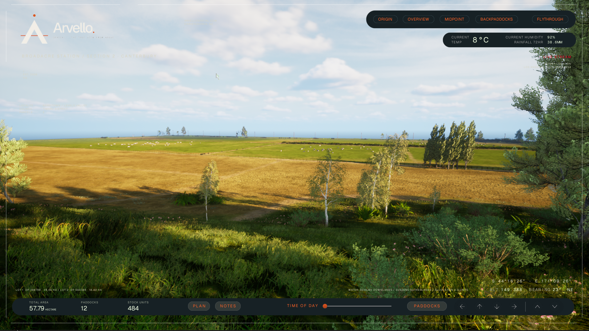
The BROADACRE Project
Our foundation build. An interactive spatial visualisation of a South Island agricultural property.